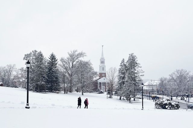
Meteorological winter’s showing up right on cue in Southern New England. With it comes our first real taste of wintry weather.
After a mild, wet Sunday and a bright but chilly Monday, a developing storm system is moving in Tuesday. This one brings a mix of rain, snow, gusty winds, and slick travel from late Tuesday into early Wednesday.
Explore top-rated stays with no booking fees and instant confirmation. Your dream trip starts here!
Start Exploring Now
First Winter Storm of the Season Targets Southern New England
The core of this storm centers on eastern Massachusetts, but folks across Connecticut—from Hartford and New Haven to Bridgeport and Waterbury—should stay alert for changing conditions. Meteorological winter runs from December 1 through the end of February, and this storm is a quick reminder that the quiet late autumn pattern is wrapping up.
Forecasters expect the storm to arrive Tuesday afternoon and exit by early Wednesday morning. They’re still watching the exact track, so snowfall amounts could shift a bit.
Still, the setup looks pretty straightforward: colder air inland and warmer air along the coast will create a sharp split between where snow piles up and where rain dominates.
Rain, Snow, and a Wintry Mix: Who Sees What?
For communities well inland, especially at higher elevations, this storm brings the best shot at meaningful, plowable snow. Heavier accumulations are likely north and west of Boston, including the northern Worcester Hills, but that pattern gives us a clue about what towns in northern and western Connecticut might see.
In spots like Torrington, Danbury, and the hill towns around Litchfield County, colder air could stick around long enough for steady snow or a snow-and-sleet mix. Along the I-495 corridor in Massachusetts, moderate snowfall looks possible; a similar setup could play out on higher inland routes in Connecticut where temps hover near freezing.
Coastal Cities Face Messy Mix and Mainly Rain
Closer to the shoreline, milder marine air takes over. Coastal Southern New England, including Boston and much of the Massachusetts coast, will probably see a messy blend of wintry stuff but mostly rain.
For Connecticut, that means more rain than snow for shoreline towns like Stamford, Norwalk, New London, and the coastal parts of Milford and West Haven. Maybe a brief burst of wet snow or sleet at the start, but with surface temps near 40 degrees, rain wins out and roads just get slushy or wet—no big accumulations expected there.
Cape Cod: Mostly a Rain Event
Further east, forecasters expect Cape Cod to be mostly a rainmaker. Any snowflakes there probably won’t last, quickly flipping to rain as the storm strengthens offshore.
The farther inland and higher up you go, the more wintry the storm. Closer to the ocean, it’s more of a chilly, blustery rainstorm.
Timeline: From Quiet Start to Stormy Finish
Before the storm, we get a real mix of weather. Sunday stays rainy across Southern New England, including Connecticut, with showers lingering but temps still mild for late November.
Monday offers a short break. Skies brighten, and many communities from Middletown to Manchester and up through Enfield get a sunny, seasonable day.
It’s a good time to finish last-minute outdoor stuff—clearing leaves from storm drains, checking wiper fluid, and making sure snow shovels and ice melt are handy.
Tuesday Afternoon Through Early Wednesday: The Main Event
Tuesday afternoon, rain showers start in western areas and spread east and northeast. By Tuesday evening, the storm really gets going, especially in eastern Massachusetts.
In Connecticut, precipitation turns steadier and heavier through the evening and overnight. Gusty winds could hit 30 mph, enough to blow snow around where it does accumulate and make it feel colder than it is.
Most places will see highs near 40 degrees. By early Wednesday, the storm pulls away, but slick spots might linger for the morning commute, especially on untreated side roads and in higher or inland towns.
Travel and Safety: What Connecticut Drivers Should Know
Even where rain wins out, gusty winds, heavier precipitation, and falling temperatures can make travel tricky. Drivers from New Britain to Bristol and along I-84, I-91, and the Merritt Parkway should be ready for:
- Quick changes, from wet roads to slushy or icy patches
- Reduced visibility in heavier rain or snow
- Ponding in low spots, especially after Sunday’s rain
- Slippery bridges and overpasses that cool off faster than the rest of the pavement
It’s smart to allow extra travel time Tuesday night into early Wednesday. Slow down in bad visibility, and keep checking forecasts as the storm’s track gets clearer.
Forecast Still Evolving
Meteorologists across Southern New England are still watching the path and intensity of this system. Even a small shift in the storm’s track could bring heavier snow to interior Connecticut or, honestly, just dump rain along the I-91 corridor.
Folks everywhere—from the coast up to the hills—should keep an eye on updated forecasts through Tuesday. The weather isn’t making it easy to plan ahead.
Meteorological winter is just getting started, and this first storm is already an early nudge about what’s coming. Whether you’re in downtown Hartford or tucked away on a Litchfield County back road, it’s probably smart to prep your car, stock up on winter supplies, and brace yourself for more snow and ice soon enough.
Here is the source article for this story: Wintry mix ‘probable’ for parts of New England next week
Find available hotels and vacation homes instantly. No fees, best rates guaranteed!
Check Availability Now

