Connecticut travelers might need to pack a little extra patience this week. A light but potentially slippery snowfall is moving in on Tuesday, right when the roads and rails are jammed with holiday traffic.
The National Weather Service expects most of the state to see accumulating snow. Even though totals are on the lighter side, commutes and travel plans from Hartford to Stamford and from Norwich to Danbury could get complicated.
Explore top-rated stays with no booking fees and instant confirmation. Your dream trip starts here!
Start Exploring Now
Light Snowfall Expected Statewide on a Key Travel Day
Meteorologists say Connecticut’s in for a widespread, light snowfall event on Tuesday. Snow should start in the morning and taper off by evening.
This isn’t a major winter storm, but the timing—right as highways, airports, and rail lines fill up—could mean delays and slick roads. The National Weather Service calls for statewide snow totals of about one to three inches, with a clear north–south gradient.
If you’re driving from New Haven up toward Hartford or from the shoreline into the hills of Litchfield County, conditions could change a lot over just a few miles.
Who Sees the Most Snow?
Litchfield County—especially those higher-elevation spots like Torrington and the hill towns near the Massachusetts line—looks like the snow bull’s-eye. Forecasters are thinking around three inches there, maybe a bit more if bands of steadier snow set up.
Central and northeastern areas will get somewhat lighter amounts. Still, that’s enough to make untreated surfaces slick.
Towns in Hartford, Tolland, and Windham counties should plan on one to two inches of accumulation. Key commuting corridors like I‑84, Route 2, and secondary roads through Manchester, Vernon, and Willimantic could get tricky.
Lower Totals for the Connecticut Shoreline and Valley Cities
Farther south and along the shoreline, slightly warmer air should keep totals lower. Even so, forecasters warn that just an inch of snow—especially this early in the season—can make for hazardous driving across busy corridors from Bridgeport to New London.
People in coastal and lower-elevation areas should expect a wintry mix. That could impact both morning and evening commutes, particularly on bridges, ramps, and those less-traveled local roads that always seem to freeze first.
Snow Totals by Region
Current National Weather Service projections:
In southern spots like Stamford, Norwalk, Milford, and New London, some of that snow may mix with or turn to rain during the day. That could keep final totals down but still leave roads wet and slick if temperatures hover near freezing.
Travel Impacts: Slippery Roads and Slow-Going
The biggest issue isn’t the amount of snow—it’s the timing. Snow should start Tuesday morning and keep coming on and off into the evening, lining up with the morning rush and peak holiday travel.
Even in cities like Hartford, Waterbury, and New Haven, where totals look lighter, untreated surfaces could get slick fast. The National Weather Service warns that slippery travel conditions are likely on roads, sidewalks, and parking lots.
Commuters using I‑91 between New Haven and Windsor, I‑95 along the shoreline, and the Merritt Parkway through Fairfield County should plan for extra time and slower speeds. It’s just one of those days where patience pays off.
What Travelers Should Do
If you’re heading to or from airports in Hartford (Bradley International) or Bridgeport, or connecting to rail service in New Haven or Stamford, it’s smart to build in some flexibility. Maybe try:
Temperatures: Cold Enough for Snow, but Not Brutal
Tuesday’s temperatures should hover in the mid to upper 30s in cities like Bridgeport and Hartford. Wind chills will make it feel a bit colder, just enough to remind you it’s winter.
Those borderline temps explain why some areas, especially near the coast and in lower elevations like New Haven and Norwalk, might see snow turn to rain during the day. Once this system moves out, Wednesday looks quieter across Connecticut, with mostly sunny skies and temperatures again in the mid to upper 30s from Danbury to Norwich.
Is This Our Only Shot at a White Christmas?
Looking ahead, the forecast for Christmas Day calls for mostly cloudy conditions and temperatures in the 20s across much of the state. That includes the Hartford, New Britain, and Waterbury areas.
Right now, Tuesday’s snowfall looks like Connecticut’s only current chance for a white Christmas. It’s not a guarantee, but it’s the best shot we’ve got.
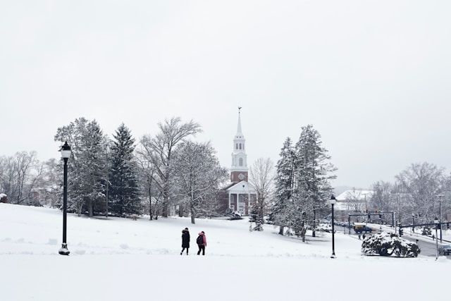
Any lingering snow on lawns or trees—especially in the colder interior and hill towns—might be just enough to make things look festive. Even if big storm systems don’t show up, a dusting could stick around and set the mood.
If you’re in Connecticut, plan for a wintry Tuesday. Stay alert to changing road conditions, and check local forecasts as the system gets closer.
Here is the source article for this story: Connecticut could get a few inches of snow Tuesday that could affect holiday travel, NWS says
Find available hotels and vacation homes instantly. No fees, best rates guaranteed!
Check Availability Now

